
St. Albans Previous Resident Sources
The backward trail for one St. Albans address spans current online records and older physical or licensed collections. Start with the source nearest the period being studied. A recent sale belongs in the assessor and deed record. A household from decades ago is more likely to appear in a directory or released census schedule.
| Source | Years It Covers | Where Held | What It Shows |
|---|---|---|---|
| Assessor parcel search | Online start not stated | Kanawha Assessor | Current owner, situs, mailing address, legal description, deed book/page |
| Land Book Viewer | 1791–1962 | Kanawha Assessor | Historic land-book pages, with remaining years still being scanned |
| Deed books and index | Online cutoff not located | Clerk Record Room and Archives | Title instruments and transfers; older access varies |
| Polk and related directories | Uneven runs from 1874–75; KCPL states 1908–present | State Archives and KCPL | Names and addresses, subject to St. Albans page verification |
| Federal census | Released schedules through 1950 | NARA, FamilySearch, library | Household and address context under the 72-year rule |
| Permit and inspection files | Archive start not located | St. Albans Building Department | Work, inspection, occupancy, floodplain, or demolition evidence |
Criss-cross directory years specific to St. Albans were not verified. Nor was a complete public obituary or permit index. Treat those gaps as reasons to ask the custodian, not as proof that no record exists. KCPL, the State Archives, and the clerk can each check collections that are not exposed as open web searches.
Start St. Albans Resident Records
Use the Kanawha County Assessor search to fix the modern identity of the property. Copy the taxing district, street or situs address, current owner, separate mailing address, legal description, map and parcel identifiers, sales history, and deed book and page. The owner’s mailing address may be elsewhere, so it cannot be treated as the address being researched.
The official search screen shows owner, address, account, district, map/parcel, property type, legal description, and deed-reference fields. 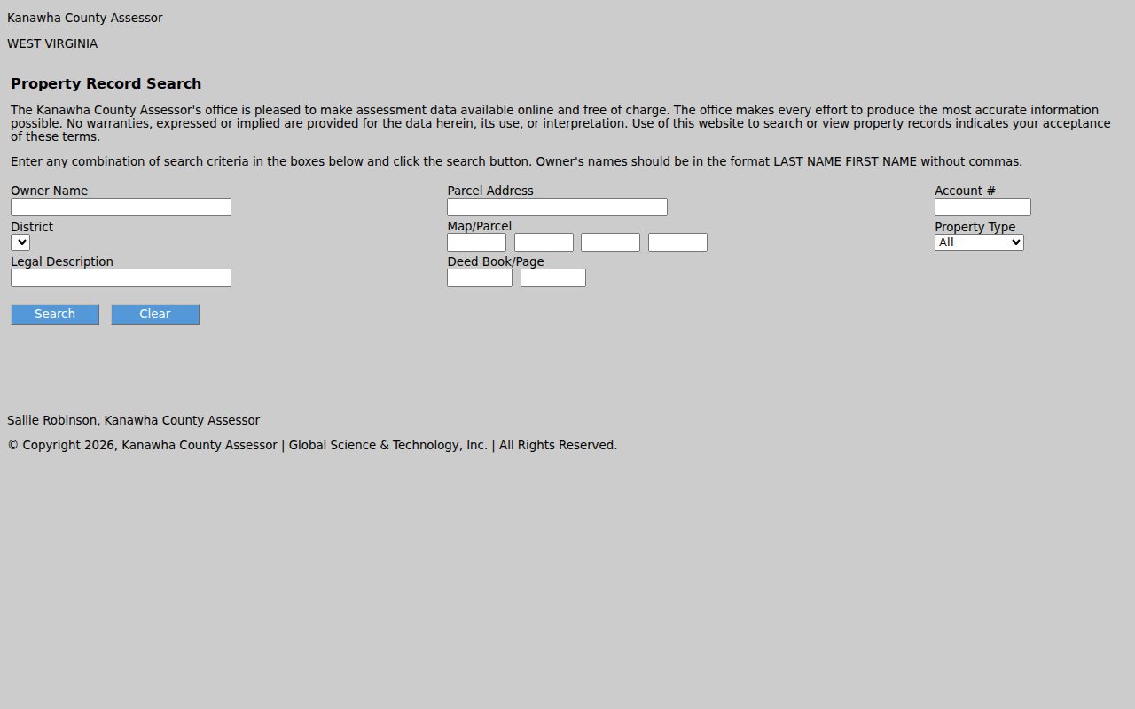 That mix of identifiers provides a durable base for moving into older books.
Open the parcel card and note its sales history, assessment entries, building-record link, map card, and tax-data link. These fields can date changes or point to another file, but they still describe the parcel. Present occupancy must be checked separately, and a homestead entry is only supporting owner-occupancy evidence. Keep each saved record with its retrieval date because current ownership can change.
Trace St. Albans Resident Deeds
A deed chain follows title transfers, not every occupant. The current parcel card supplies the first recorded book and page. Kanawha County has not published a verified official public grantor-grantee search URL or online cutoff in the sources inspected, so the County Clerk Record Room is the working route after that first reference.
- Save the current owner, legal description, parcel identifiers, and deed book/page from the assessor card.
- Ask the Record Room for that purchase instrument. Record the grantor, grantee, execution and recording dates, instrument type, consideration if shown, and any linked plat or release.
- Treat the current owner as the grantee. Take the seller, or grantor, and find the earlier deed where that person received title.
- Repeat the pattern through ordinary sales, deeds of trust, releases, probate transfers, partitions, estate conveyances, and subdivision plats.
- When the office index or modern records stop, continue with deed books, land books, and State Archives microfilm.
- Grantor / grantee
- The grantor transfers an interest; the grantee receives it.
- Chain of title
- The linked sequence of recorded transfers for the same land.
- Legal description
- The lot, block, survey, or boundary language that identifies land even when a street number changes.
Match the legal description at every step. Similar names and reused house numbers can otherwise join the wrong parcel. A deed can identify an owner or heir, but it does not prove that person occupied the property.
St. Albans Deed Record Gaps
The absence of a public web index is not the absence of deeds. Call the Record Room at 304-357-0240 or send a narrow request with the names, approximate date, parcel address, legal description, book/page if known, and document type. Counter, phone, fax, and West Virginia Freedom of Information Act routes are documented access channels.
Older county material also appears on State Archives microfilm. Its services note that county runs can be incomplete and that land, tax, will, survey, and court sources have different ranges. The Kanawha courthouse has never burned, according to the State Archives. A missing online result is therefore more likely an indexing, digitization, or access problem than proof of fire loss.
State Archives lists early Kanawha court record books for 1788–1803, 1819–1863, and 1873–1878, plus an Index to Law and Chancery Records for 1818–1944. Those are separate collections with different record placement. Ask staff which catalog group fits a deed, estate transfer, tax entry, or court dispute rather than assuming one index searches them all.
St. Albans Land Book Records
The Kanawha Assessor Data Inquiry states that its Land Book Viewer covers 1791 through 1962 and that remaining years are being scanned. Land books support a long ownership and tax trail, but they are not a modern street directory. Early entries may depend on owner names, districts, acreage, or legal descriptions rather than a familiar street number.
The captured data-inquiry page points researchers toward that historical viewer. 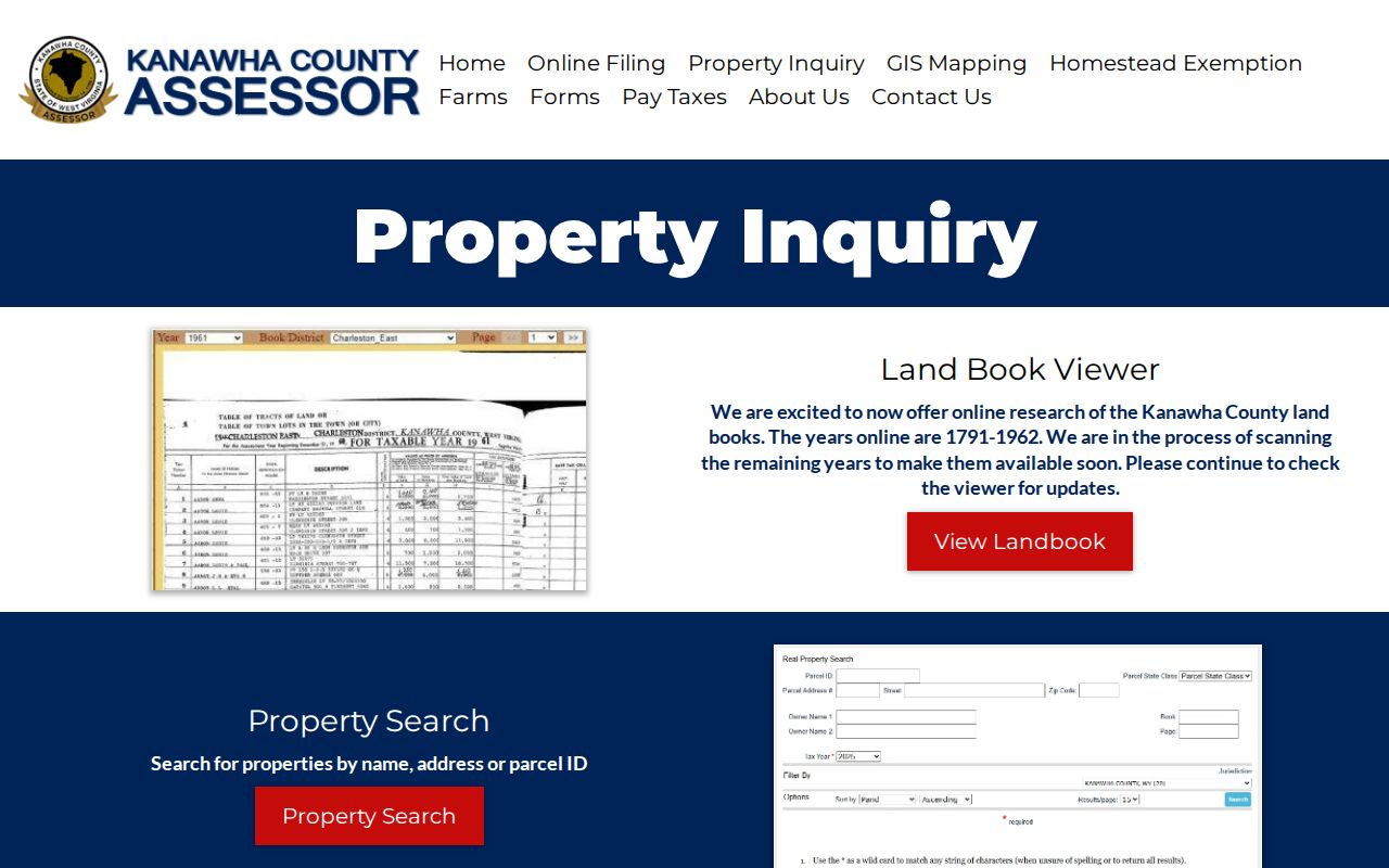 Pair each land-book finding with the deed chain before assigning it to previous residents.
St. Albans Resident Address Changes
No verified official source gave a specific citywide renumbering or renaming year. West Virginia filing rules call for a certified municipal map or street-name and number-range list after annexation or a street change. Ask the St. Albans City Clerk and Kanawha County Clerk for those maps when the old and new addresses conflict.
Compare the legal description, parcel geometry, subdivision plat, ward or precinct map, directory spelling, and surrounding households. St. Albans also passed through Coalsmouth, Jefferson, and Kanawha City naming eras. Railroad arrival and the 1871–72 identity shift can change the heading under which an older source files the same area.
The Main Street fires of 1906 and depot rebuilding after the 1910 fire create more local breaks. A directory may preserve an old number while a later permit uses a new one. Record both forms and the years in which they appear. Never merge two household trails merely because the modern map places the addresses close together.
St. Albans Resident History Help
Kanawha County Public Library offers local-history reference help, directories, and an obituary request form. The State Archives offers written research services and county-record microfilm. The St. Albans Historical Society holds artifacts, landmark pages, and newsletters, including the Coalsmouth Journal for 1972–1988 and later newsletters from 1992 forward.
No formal St. Albans house-history guide or advertised research service was located. Supply a current number, legal description, parcel ID, and known owner variants when asking for help. Historical Society material on the depot, Main Street, and fires can explain changes to the built setting, but it cannot replace a title or permit record.
St. Albans Resident Map Evidence
Fire-insurance maps can show a building footprint, materials, use, and street setting for a specific publication year. The Library of Congress provides an official Sanborn map search guide, but research did not locate a St. Albans item. Search the catalog first and cite only a verified sheet.
Main Street fires in 1906 and the depot fire and reconstruction in 1910 are useful reasons to compare maps, permits, directories, and newspaper notices around those dates. They are not proof that a particular house changed. The city’s 1871 depot, later replacement, closure, city purchase, and 1997 National Register milestone supply more search terms for nearby landmark records.
St. Albans Past Household Trail
Owners are only part of the story of previous residents. A dated city or criss-cross directory can associate an occupant with an address, while a released federal census schedule can add household members, relationships, and other period context. KCPL states that its Charleston and neighboring-suburb directory coverage runs from 1908 to the present. The State Archives lists uneven Polk runs from 1874–75 through 2016. Confirm that the selected volume actually includes St. Albans.
Work in a short loop: locate the address in a directory year, save the exact printed spelling and names, check the nearest released census schedule, then return to the next directory year. Person-level census schedules follow a 72-year release rule, with schedules currently released through 1950. The full collection detail belongs on the St. Albans city directory page.
When an occupant disappears, use the KCPL obituary request, newspaper collections, and probate or recorded estate conveyances. An obituary can identify relatives and a last residence. Probate may connect heirs to the next deed. Neither source should be used to infer a current address that it does not state.
Cemetery records and delayed vital records may add dates or family links, but access and coverage differ. Keep the source citation beside each claim about previous residents. If two people share a name, require another match such as a spouse, relative, address, deed role, or publication year before joining their records.
Lawful use. Research St. Albans past residents for lawful house history, genealogy, estate work, or personal study. Never use a historic trail to harass, track, or expose a living person.