
Walk a St. Albans Street
Begin the street directory with the place itself, not a guess about a person. The Kanawha County Assessor connects a parcel address to a current owner, legal description, map and parcel numbers, and deed book and page. The West Virginia Property Viewer then shows that parcel beside the rest of the street. Those records establish ownership and geography. They do not establish that the owner lives there. A voter record or dated directory can add evidence of residence, but each has its own limits.
A good by-address search records the source and date of every match. It also keeps the situs address, meaning the physical parcel location, separate from the mailing address used for tax notices. Follow this order:
- Enter the address in the Kanawha County Assessor search. Save the current owner, situs, mailing address, legal description, parcel identifiers, and deed book and page.
- Open the same place in the West Virginia Property Viewer. Check the parcel outline and nearby parcels instead of treating a street number as a boundary.
- Use the Secretary of State voter lookup only when the required name and date of birth are already known. For a lawful public-list inquiry, contact the county voter office.
- Give the deed book and page to the Kanawha County Clerk Record Room. Ask for the purchase instrument and work backward through grantors and grantees.
- For an earlier household, check a dated criss-cross or city directory through the library or State Archives, then verify that St. Albans appears in that volume.
St. Albans Assessor Address Fields
The Kanawha County Assessor Property Record Search is the strongest first stop for a current St. Albans parcel. It accepts several keys, which helps when an address is incomplete or spelled differently. Owner names use the form LAST NAME FIRST NAME without a comma. The portal does not state its online coverage start, so a result should be read as a current property record rather than a complete history.
| Search field | Input | How it helps |
|---|---|---|
| Owner Name | Text | Find parcels tied to a known owner |
| Parcel Address | Text | Search the physical or situs location |
| Account or Map/Parcel | Identifier | Return to the same property without relying on spelling |
| District or Property Type | Dropdown | Narrow a broad address result |
| Legal Description | Text | Match lot, block, or deed language |
| Deed Book / Page | Two fields | Bridge the parcel card to the recorded instrument |
The captured assessor screen shows the official starting form. 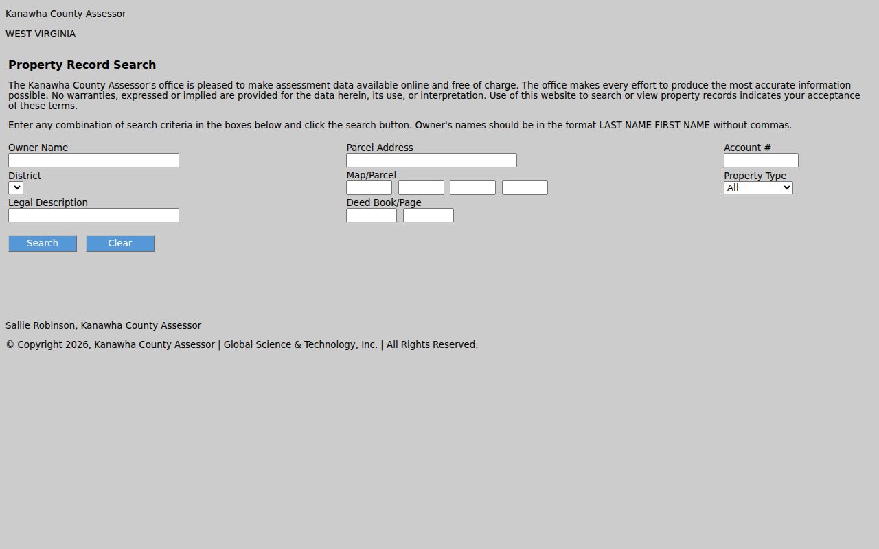 Its range of fields makes the street search more reliable than matching a name alone.
St. Albans Situs Versus Mailing
Address research must preserve a key distinction. A situs address locates the taxable parcel. A mailing address tells the assessor where to send owner correspondence. The two may be the same, but an out-of-town mailing address does not prove that the St. Albans building is empty. Likewise, a local mailing address does not prove day-to-day occupancy.
- Parcel
- A mapped unit of land used for assessment and record placement.
- Situs address
- The physical address assigned to the parcel or improvement.
- Plat
- A recorded map showing lots, blocks, streets, or a subdivision.
- Criss-cross directory
- A directory arranged by street and house number so an address can lead to a named occupant.
Homestead treatment may support an owner-occupancy inference, but it is not conclusive proof that a named person is present now. Avoid exposing exemption details when the street question can be answered through less sensitive fields.
Map St. Albans Streets in GIS
The West Virginia Property Viewer adds the map context that a parcel card lacks. Search by E-911 address, county plus owner, property address, parcel components, whole parcel number, coordinates, or drawn geometry. Partial owner names are accepted. An address search may also work with only the street name when the statewide property address is incomplete.
Zoom close enough for parcel boundaries, then click the outlines along the street. Result rows can show GIS ID, owner name, and address, while flood-zone and tax-district layers explain other geographic facts. The viewer caps results at 1,000. Its boundaries come from assessment mapping, not a legal survey or title opinion.
The official viewer screenshot shows the mapping workspace and search controls. 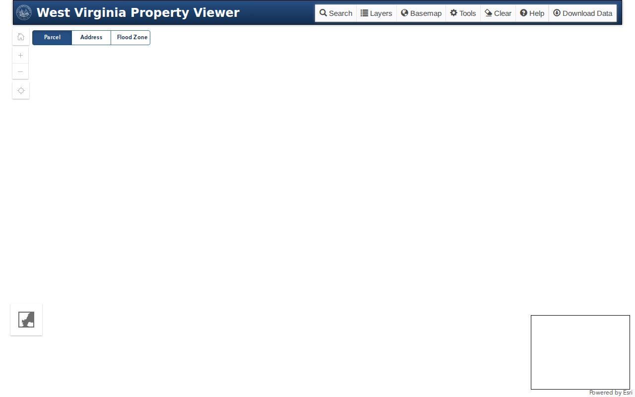 Use the resulting GIS IDs to keep adjacent parcels distinct when house numbers repeat.
Geometry tools can draw a point, rectangle, or polygon and apply a buffer around it. Measure mode must be turned off before selecting a parcel. Share controls can generate a link based on a map click, map center, or parcel, which helps preserve the exact view used in a by-address search. Printed maps accept a short title and note, but the parcel card and recorded deed remain the sources to cite for ownership.
Address tip. E-911 search rejects rural routes and post office boxes, so switch to a street name, owner, or parcel parts when an exact address fails.
St. Albans Street Record Coverage
Several public sources support a St. Albans street directory, yet none is a complete occupant list. The assessor and GIS are online. Deeds require the Record Room route when the parcel card stops. City permit files are requested from Building and Zoning, and older address evidence is reached through the library or archives.
| Record Set | Keeper | What It Shows | Access |
|---|---|---|---|
| Parcel card | Kanawha Assessor | Owner, situs, mailing address, legal description, deed reference | Free web portal or real-estate line |
| GIS parcel | WV GIS Technical Center | Parcel outline, ID, owner/address result, flood and tax layers | Free map viewer |
| Deeds and plats | Kanawha Clerk Record Room | Grantor, grantee, instrument, book/page, title chain | Counter, phone, fax, or FOIA request |
| Voter record | County Clerk and WV SOS | Permitted registration, status, party, district, and residence fields | Person lookup or regulated office inspection |
| Permit and inspection | St. Albans Building and Zoning | Project, inspection, certificate, floodplain, or demolition evidence | Department or city records request |
| Historic directory | KCPL and State Archives | Dated occupant associated with a printed address | Library, catalog, microfilm, or research request |
A parcel number and legal description make the best links between map, assessment, and deed sources. Street wording then helps locate permit and directory entries. Where an online tool does not exist, call the Record Room at 304-357-0240, use the city public-record form, or send a narrow West Virginia Freedom of Information Act request to the office that keeps the record.
Deeds Along St. Albans Streets
The assessor’s deed book and page are a bridge, not a deed index. Kanawha County identifies deeds and liens as Record Room functions, but research found no verified official public grantor-grantee interface or online cutoff. Give the clerk a precise book/page, legal description, parcel address, approximate date, and document type. That is far more useful than asking for every owner on a road.
For a prior owner, read the current purchase deed and note its grantor, the seller. Then search that seller as a grantee in an earlier purchase. Repeat while matching the legal description. Releases, deeds of trust, probate transfers, partition deeds, estate conveyances, and subdivision plats may appear between ordinary sales. A deed proves a title event, not residence.
For a street-wide project, build the sequence parcel by parcel from GIS IDs, not from a loose list of surnames. Group matching lot and block references, then ask for the subdivision plat if the boundaries remain unclear. Older court, deed, and tax material may require State Archives microfilm or written research help. That slower route guards against joining two parcels that once shared a similar street label.
St. Albans Voters by Address
The Secretary of State’s Am I Registered to Vote? form is person-based. It requires first name, last name, and date of birth, and can return status, party, districts, and polling place. It updates nightly. It does not offer a street search, so it cannot be used to sweep a road from the public form.
West Virginia Code section 3-2-30 permits inspection of specified voter records and provides county read-only terminals and printed lists. Public fields can include name, residence address, party, status, and precinct or district data. Phone, email, Social Security number, and driver or state ID numbers are withheld. Printed noncommercial lists cost one cent per name, while solicitation, advertising, resale, and related misuse are prohibited.
St. Albans Permits by Street
Building and Zoning records add the history of work at an address. Available files may include permits, inspections, floodplain determinations, certificates of occupancy, vacant-building registrations, and demolition agreements. No public address-search portal was located, so use the St. Albans Building Department or the City Clerk’s public-record request route.
The city’s 2024 paving schedule names segments of Morrell, Vine, Willow, Ben Road, Washington, South Walnut, Rockwood, Fernwood, Spring/7th, Park, Helene, Highland Terrace, and Maple Lane. That schedule is evidence of municipal work, not ownership. Utility pages likewise describe owner notice when property sells, but no public customer-name list or account search was found.
Old St. Albans Street Numbers
No official source located in the research gives a single St. Albans renumbering or renaming year. West Virginia law does require a municipality to file a certified map or list of street names and number ranges with the county clerk after an annexation or street change. That gives the search a practical fallback when a historic directory number does not match today’s map.
Compare the modern parcel, legal description, current ward and precinct maps, old directory spelling, and any recorded plat. Legal descriptions tend to outlast a house number. St. Albans also passed through Coalsmouth, Jefferson, Kanawha City, and St. Albans naming eras, so old records may be filed under a wider Kanawha or Charleston heading.
Historic St. Albans Street Directory
A reverse or criss-cross volume turns an address into an occupant name. Kanawha County Public Library describes Charleston and neighboring-suburb directories from 1908 to the present, while the State Archives lists uneven Charleston and Kanawha Polk runs beginning in 1874–75. Those labels do not guarantee a St. Albans page. Inspect the specific volume before citing an occupant.
The St. Albans city directory collections are the right place to study publishers and surviving year runs. For a street search, use only the volume’s address section, spelling key, and publication date. Exact St. Albans reverse-directory years were not located, so neither an undated scan nor a catalog label should be stretched into a claim.
Limits of St. Albans Street Lookup
A street directory cannot name every person inside a home. Property records identify owners, not all occupants. The public voter form needs a known person and birth date, and protected fields remain closed. Utility customer lists were not located as a public source. Address Confidentiality Program participants may use substitute addresses, which must never be reverse-engineered.
Commercial directory data may be stale, copied, or detached from its source. Prefer an official parcel, clerk response, dated directory page, or city record, and keep the date of retrieval. If the question shifts from a whole road to one named person, the St. Albans resident lookup explains how to confirm identity without treating a shared name as proof.
Lawful use. Use St. Albans address records only for lawful personal, historical, property, or civic research. Never use them to stalk, harass, threaten, or expose a protected address.